Friday, August 8, 2014

Kayak Overnight


 The white line shows my rough track.


I've never traveled overnight by kayak.  Last winter I planned an overnight using my two-man kayak, Serendipity--even going as far as loading gear into the drybag--but circumstances prevented.  I still wanted to go kayak camping, and it occurred to me that, with the lighter gear requirements of summer camping, I might be able to cram enough stuff into my single-seater, Musketaquid.  Over a few days, I fiddled with gear, making it fit and still get the balance right.

Yesterday the opportunity came for a little test run: the rest of the family was out of town, I had no appointments, and tide and weather looked manageable. 

I put the kayak in the Assonet River in early evening at the top of the flood.  An evening departure risked not finding a campsite in daylight, but parts of Assonet Bay turn almost into mudflats at low tide, and I didn't want to fight current, so I needed to wait until high slack tide.  I paddled under the highway, across the Bay and down the short river (the gentlest breeze against my face) to its confluence with the mighty Taunton, then up a little salt marsh creek as the sun set; total distance three miles.

There are few places one can camp ashore, which is one reason I almost always sleep aboard when sailing.  But Google Earth showed this particular bit of river bank to be uninhabited, with no buildings close by. 
Entering the creek, I annoy a pair of majestic ospreys.  In the past, I've seen ospreys only around nest platforms,  but this pair seemed to have found their own nest site. 

I worried that there might be no accessible shore to land on, but a short distance up the creek a bank appeared right up against the high mash, allowing me to go ashore as if on a dock.  Climbing through the bullbriar in the twilight, a nice grassy spot appeared.  But I moved on when I realized the standing dead tree beside it was poised to fall.  I at last found a camp site that was open, level, and easy to clean up.  By the time I had all the gear at the campsite it was quite dark, and I put up the tent by the light of my little headlamp.  By 9pm I had my stuff organized, mattress inflated, and had poured myself a glass of cabernet.  (Whether sleeping in a boat or camping ashore, the evening isn't complete without red wine.)

Checking my bird book, I confirmed the identity of the ospreys, and also learned that they are unique among raptors by diving headfirst into the water and catching fish with their feet.  Shortly after, a great splashing sound from the creek was perhaps a fishing osprey.

My light fleece bag turned out to be unequal to the nighttime temperatures, and I was rather cold. 

I was up next morning at 5:10, bolt upright and filled with foreboding: I had left the kayak on the high marsh beside the creek, and tides were getting more extreme as the moon neared full.  Would my kayak float off?  The boat was indeed almost afloat when I got to it, but still firmly stuck in the grass.  I broke camp, about as quickly as I was able, only stopping to make coffee: this time I didn't want to fight the current going back upriver in the middle of the ebb. 

Nevertheless, I made time to explore a bit in daylight, and to paddle the rest of the way up the creek.  Coming back down the creek, I watched the Phragmites freshwater marsh give way to a narrow band of cattails, then Spartina saltmarsh.

I was out of the creek and on my way a little after 7am, hoping the current wouldn't be too strong.  In the narrow part of the Assonet River the current was running at about one knot against me--a little annoying, but not insurmountable.  (I broke from working against it to try to capture a half-dozen swallow-like birds playing around a dock, but was too slow with my camera.  They reminded me of chimney swifts, but with more deeply-forked tails; bank swallows and tree swallows are possibilities.)  Another worry was the current under the highway, but I slipped through in the shallows without an issue, landing back at my car before 9am.

I was quite satisfied with the trip.  I may try to do our regular Boston Harbor Islands camp out by kayak.  It was pleasant to have little enough stuff that it wasn't a major production to pack and carry gear, and make and break camp.


Ready to push off. 


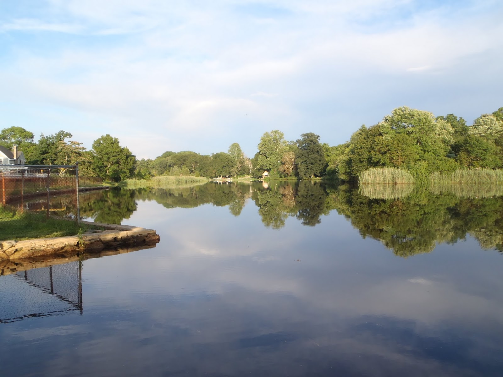
Barely a ripple on Assonet River.


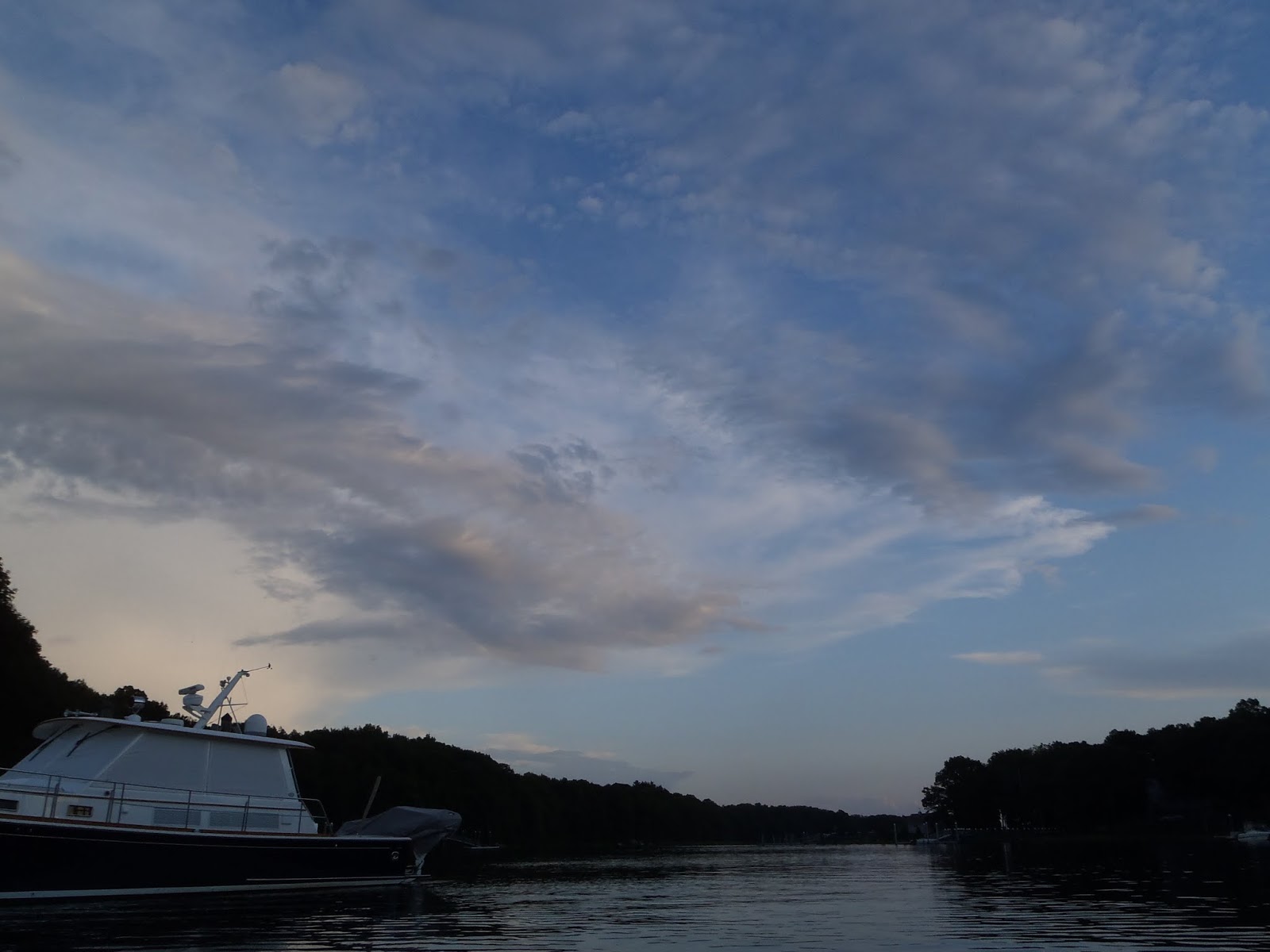
 Beautiful and complex sky over the river.


Tall saltmarsh cordgrass, Spartina alterniflora, is in full bloom.


Taunton River, then zoomed in on the distant Braga Bridge.


Approaching salt marsh and creek as sun sets.

All this stuff came out of a twelve-foot kayak.

This dead tree was so rotten I couldn't figure out why it was still standing.
I camped elsewhere: a dead tree fell very close to me during a blizzard not long ago.  
The tapping and call of downy woodpeckers showed that dead trees were common.


The marsh at dawn.  I was glad I decided not to camp on the marsh itself 
when I saw how far the tide rose in the morning.  A marsh bird made a whirring call.


 My campsite turned out to be at the foot of 
two red oaks and a red maple.


The mouth of the stream from the hilltop above camp.


A broad path shows that others have been here, but trees
fallen across the trail argue that it has seen no vehicles recently.


For me, black birch is one tree that says "wild New England."

Bullbriar, with its wicked thorns, was everywhere, complicating walking
in the dark and the search for a campsite.  I lost a bit of blood this trip.


The area had not one but two kinds of blueberries:
a highbush form, and a lowbush.


This delicate little plant is a relative of Solomon's seal.

The short cordgrass of the high marsh, Spartina patens, is just flowering
--a little behind its sister species.


Looking upstream and down as boat is loaded.


Farewell to the marsh.


Head of navigation; stream so narrow it's hard to turn around.

Headed back downstream.

Headed back into the Taunton, then for home.

Thursday, July 17, 2014

Massachusetts Bay, Day Three

I climbed out of my bunk just after 6am while Stephen slept on.  This time, the boat had settled pretty high up the beach, having swung with a wind shift in the night.  (That solved the mystery of why we grounded so early in the ebb.)  The rocks we settled on were bigger than pebbles, big as cobbles, in fact.  But I sighed with relief when I realized it could have been much worse: only a couple yards away, and well within reach of our anchor line, were  boulders.  

After setting water to boil for coffee, I uncleated the anchor line and shifted the anchor to the middle of the beach, planning to move the boat as soon as she floated.  Then I went ashore and got a brochure and map, and studied the trails and sights as the coffee brewed.  Meanwhile, a dink arrived on the beach with a sailor and his dog, and my greeting brought Stephen's head out of the companion.  We ate the last of the croissants, with coffee and orange juice, and watched the dog and his owner play as we waited for the flood tide to lift us.  This would be a relaxing and leisurely exploring day, since we were only 8 nautical miles from our final destination and could not complete it until late in the afternoon when the flood tide was well underway.

At length the boat floated.  I maneuvered her into safer water, but discovered that no reasonable scope of anchor line would keep her off the beach for a long while, so Stephen gave the boat a good push from shallows, while I knelt on the foredeck to drop the anchor farther out.  The kayak brought me back, and we put it high on the beach as insurance before we headed off to explore.

Great Misery has had a varied history, named by a sailor centuries ago who wrecked there and was stranded for days, variously owned and farmed and used with no great success in the centuries after, more recently turned into resorts twice, again both failures, until the Trustees of Reservations bought it prior to the second World War.  Despite all the human influences, the island is still quite pretty, if you're not expecting wilderness.  In fact, I find ruins interesting, stimulating our imaginations as we try to mentally reconstruct buildings from the remaining foundations.  Compared to the Boston Harbor Islands we have camped on, the trails here are genuinely captivating, with high bluffs giving good views in many directions.

Over several hours we walked nearly every trail on the island, only returning a couple of times to see the boat riding safely in deep water.  At each visit, we saw that more and more boats had moored for a visit, and several people and families were now ashore, joining the dog and his human.

At last I decided I had seen enough, as we stopped on a hilltop overlooking the cove.  I decided I would stay there in the shade until the tide had dropped enough for me to wade out to the boat no more than waist-deep.  Stephen declared that it was already so, and set off down to the cove to prove it.  Getting aboard when a chance breeze brought the boat close enough, he settled in to wait there.

Perhaps an hour later a tiny landing craft arrived bearing the awaited ranger.    The ramp came down, and the ranger wheeled a mower ashore for trail work.  (I later learned that Stephen had greeted the ranger from the boat, complimented him on his island, and tried to pay him the ten dollar fee for our visit.  That's my boy!)  At that point I went down too, and was soon aboard.

We weighed anchor at noon, and sailed slowly out of the cove on the light wind.  Since we had only a short distance to go and time to spare, i opted to leave the mizzenmast in the middle step and sail with that alone.  With the wind as light as it was, I came to regret the decision.  After a reasonable start, the wind died in the afternoon, and we eventually found ourselves bobbing near the mouth of Gloucester Harbor, with barely enough wind to keep pointed in the right direction.  

Impatience sent me to the oars, and for the first time in years we set them in the oarlocks, made me up a makeshift rowing seat, and I set to work moving the ton of boat the hard way in the sun and heat and humidity.

Stephen steered as I worked on getting the angle of the blades just right, and the rhythm, and we found I could maintain 2 1/2 knots if I rested briefly every few minutes.  Well into the harbor a little breeze sprang up, and we wasted no time in getting back under sail.  Our timing was good, since the flood tide we needed for the Blynman Canal had begun.


We searched the side of the harbor for the entrance to the canal, and the bridge we would need lifted, and finally discovered it when we happened on the right angle to make it visible.  The bridge operator confirmed that the potentially tricky current was now flowing into the canal (good), but that, no, he wouldn't lift the bridge for us.  "You'll have to lower your masts, Cap'n."  We hove to without a minutes pause, dropped both masts, and paddled into the narrow canal as the bridge lifted twice for larger powerboats.  We never did learn why the operator wouldn't lift for us, though the published rules gave no such hint.  In the end, with the current in our favor, it was not difficult to paddle the 1/3 mile up the canal to the ramp, and we tied up at 5:30pm.  

We had a lot of time to ready the boat for trailing, since Beatrice was stuck in traffic and didn't arrive for more than an hour.  We were very glad to see her when she did.  We would have some stories to tell.


 Great Misery at bottom left, cut off; Gloucester Harbor at top left is obscured
by the cartoonishly exagerated GPS track.


The Beatrice Ann's resting place in the night.  
If the wind had gone a little more easterly, we'd have been on the nearer rocks.

Breakfast of croissants, cold cereal, juice and coffee.

She will float in a few minutes.

The pond, only yards from the cove, is fresh.
The stone structure was a pump house.


All but one of the moored boats left in the night.

Safely afloat.

Looking east from the east end of the island.


Little Misery has a nice little beach with some protection,
and if the tide were low we could wade across.

Evidentally the same family that importuned us last night.

Looking down from near the "Casino."  The rock formed a "salt water swimming pool" for the resort.

These sulfur-colored lichens seem to like coastal rock--it's all over Boston Harbor Islands, too.
Saucer-shaped structures disperse tangles of fungal filaments and algae to reproduce the lichen.

The "Casino."

Steps to the "Casino."

Casino foundations indicate a big common room (dance floor?)
with a big front deck, in this beautiful hill-top location.

Not Stonehenge, but the foundations for a water tank.
Stephen shows each pillar to be about ten feet tall.


Pamphlet calls this "bleak house," but has no other information.

At times people attempted farms.
Water tank foundations in distance.

"See?  It's not too deep to wade!"  But I prefer to wait a little.


In the shade, waiting productively.

Ranger arrives with mower.

Misery Island astern.

Light marking the entrance to Gloucester Harbor.

Where is the entrance to the Canal?

Blynman Canal.  Bridge operator: the current is favorable, but slow.

"Can you raise the bridge in a few minutes?"  "No, Cap'n.  You'll have to lower your masts."

The ramp.  Time to pack up and wait for patient Beatrice.