Saturday, June 30, 2012

Around Cape Cod: Day 5

Provincetown: the bar we grounded on is the light diagonal line extending from inside the middle of Long Point.  The dike we walked runs from inside end of Long Point to the edge of downtown.

I slept a little late, convinced we would be staying in Provincetown this day, come what may.  I climbed out, refreshed, at about seven to find we were aground on a bar a little distance from the beach.  Leaving Trevor sleeping, I took a walk barefoot on the bar, admiring shells and rocks, waded the tidal creeks, and returned about an hour later.    Rain sent me into the cabin Trevor had buttoned-up the cabin in my absence.  We ate breakfast and read while the rain pattered occasionally.

Grounded on a bar, Beatrice Ann is little the worse for wear after her adventure.  Even my splinted sprit was okay.

Late in the morning I called Bea for a weather update.  After hearing it, I needed no convincing that I should not risk crossing Cape Cod Bay for the next two or three days.  I wondered aloud whether Bea could come and get us?  She could.  We floated about noon, sailed over to town to scope out the ramp we'd seen while on foot the day before, toured the shoreline a bit, then sailed up to the beach to await her arrival. 

An amazing "houseboat" in Provincetown Harbor features Frank Lloyd Wright styling, good ventilation, solar panels and a shaded wrap-around porch.  Hanging plant on the right hand end for that homey feel.

It was a nice ramp, and not crowded.  The Beatrice Ann took up a lot of real estate on the small beach without appearing to be in anyone's way.  People swam, frolicked with their dogs, took out kayaks and a Sunfish.  I sat on the prow reading Outermost House, stopping now and then to resettle the bow on the beach as the tide rose and fell.  Trevor read in the cabin.
 
Bea and I once stayed at the Land's End B&B visible rising in ornate glory on the hilltop

We were all in the car headed out of Provincetown by 4pm, stopping at Moby Dick's in Wellfleet for a welcome dinner.  At home, I "saw to the horses first" by unloading the boat and beginning the cleaning process before going into the house to get clean myself.  As I worked, I left the vhf radio on, since it had up and decided to work again.  It suddenly erupted into warnings of severe weather--bands of thunderstorms, winds gusting to 38, hail, and so on--picked up on doppler radar all over the coastal waters, at a time we would have far out had we sailed that day.  Before this, such a warning would have been purely intellectual--now a little experience invests it with a visceral punch.  Never again will I take such a forecast lightly.

Beatrice and Stephen got us, then treated us to fish & chips, shrimp and fried clams at Moby Dick's.  A Fudgy Wudgy, cheesecake, and two Freezese capped it off.

Friday, June 29, 2012

Around Cape Cod: Day 4

the red line shows a distanc of 5 nautical miles, so our rough position.

We woke about 10am, having dropped anchor behind Long Point only six hours earlier.  Thinking it was already rather late to be starting across Cape Cod Bay to Plymouth, we might as well go into town.  The shore was about 100 feet to leeward, so I let out all the scope we had, added a second length of rode, and then brought the transom within reach of the beach with a paddle.  (On reflection, the whole affair took longer than it would have to simply inflate the kayak and paddle ashore.)  Leaving a second anchor from the stern to 
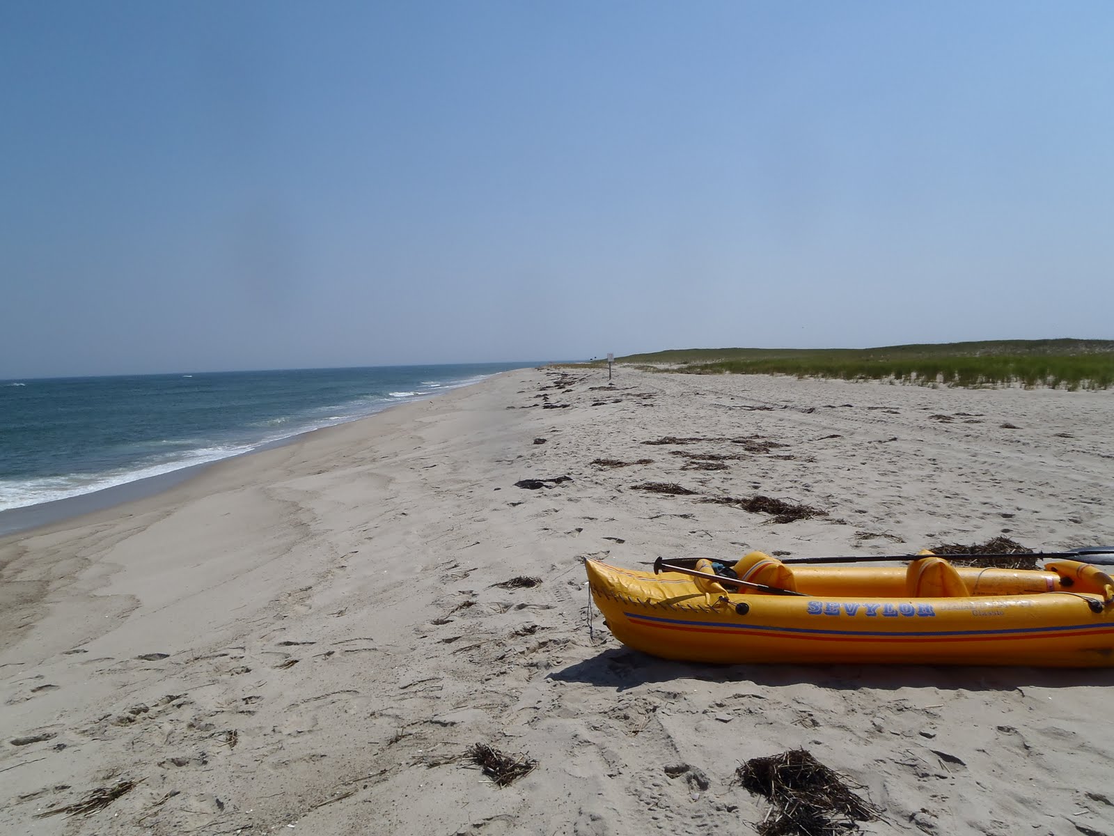
ensure a wind shift didn't carry the boat out of reach, we walked the quarter mile of beach and the mile of picturesque stone dike into Provincetown.  It was about two hours before high tide.  Our plan was the same as in Chatham: scope things out with an eye to finding something to eat and drinks in cool AC comfort.  We settled on a pizza place that also advertised ice cream.  

The dike is about a mile long, and a pretty walk into Provincetown.


The salt marsh and pond maintained by the dike.

These great fat ducks--common eiders, I think--seem to prefer swimming to flying.

Beatrice Ann anchored off Long Point.

We were back aboard about 3pm, half a large cheese pizza inside us and the rest in hand.  The ebb had begun.  I phoned Beatrice to get the latest NOAA weather forecast.  Winds southwest at 5 to 10 going west about 6pm, and possible thunderstorms from a coming cold front late at night.   Not great--but the frontal weather was to be with us right through the weekend.  I decided we would go for it.  It would mean doing most of the crossing after dark, but I was used to this, and had long-since laid in the gps coordinates that would see us safely into either Plymouth or the more northerly Hingham, near Boston.  (On an earlier crossing years before, we had started even later than this.  It was my first long night-crossing, and I still remember that night on Cape Cod Bay as a magical.)  Although I should have been tired, I felt pretty good.  Beatrice didn't exactly object, but I could hear worry in her voice.

Returning to the boat, tide falling but a bit higher than we left.  The Mayflower Memorial tower is visible at left in Provincetown.

 We got things ship-shape with all speed and got the anchor up.  I told Trevor that, to make so long a trip after so short a night, he would have to do a good deal of the sailing.  In his confidence he was ready to do all of it; we compromised: he could sail until full dark, then we would see.  He had rather enjoyed a little night sailing under a fingernail moon the night before.  I settled into my bunk and pretended to nap.  In reality, I was evaluating Trevor's sail trim, his course-keeping, and his reactions to events.  He did pretty well, even after a wind shift headed us, so he was no longer able to stay on the gps line.  I relaxed and daydreamed.

Five or six nautical miles off shore, I noticed that Trevor was luffing pretty continuously: I went into the cockpit to find him spilling wind to keep her on her feet.  He was ready to hand over the tiller.  On that day a new idiom entered Trevor's vocabulary: "out of my league."  While I explained that we could balance the boat better with both of us on the windward side (my bunk was on the leeward), and reef if we needed to, it quickly became apparent that a reef was an urgent priority.  The sky ahead was dark, lightning flashed in the distance.  Events were getting way ahead of me: I initially planned to reef the main alone, since the boat can't ride hove-to while reefing the mizzen, but by the time we were hove-to and I was on the foredeck, I couldn't even do that.  This was out of my league, as well.

My sails are sleeved and furl around the mast.  Furling or reefing the main in any kind of wind requires rotating the mast--usually not difficult. But the increasing wind put so much strain via the flogging sail that I couldn't budge the mast, no matter how I positioned myself on the tiny bit of deck.  Added to that was a new worry: the mizzen was unable to hold the boat head-to-wind since it was drifting backward so quickly that the rudder would steer it on the wind, then the boat would heel perilously on mizzen only, round up with agonizing slowness, repeating this at seemingly random intervals.  Wind and waves still building, my mind rapidly shifted gears, from "we need to reef" through "we need a way to ride this out," and "we need to turn back," to "I don't want to die."

Fearing a capsize, and unable to come up with a plan that couldn't make things worse, I told Trevor to leave the tiller alone and hang on tight.  Since I couldn't deal with the violently flogging mainsail, I reached into the forepeak and got out the drift sock.  I had long ago thought that this cheap fisherman's drift anchor might help with reefing under way, but my few experiments had been disappointing, and the sock was stuffed in among the anchors "just in case."  With no spare rode in easy reach, I tied it to the other end of the main rode and lowered it carefully over the bow.  In moments the strain on the rode was too great for a hand alone, and I cleated it off perhaps fifty feet off the bow.  Instantly the bow came obediently into the wind and the boat began riding properly.  Enormous relief!

 Now my undivided attention returned to the main just as Trevor cried out and pointed: the cheap aluminum carabiner (really a key ring) that I used to fix the sheet to the clew had carried away, and the main swung free of any impediment.  I shouted to Trevor that that was good news: had the sheet caught on anything for even a moment, we would have been swimming.  I knelt on the deck on the lee side of the mast and pushed with all my might to counter the pressure of the wind, and was able to rotate it a quarter-turn.  Once it had made a few rotations, the shrinking sail area began to make the job much easier.  By the time I had secured the sail, a plan had formed in my mind.

 The mizzen furled more easily, since I could stand and lean against the mast and its area was smaller to begin with.  Without the mizzen, the sock alone held the bow about forty-five degrees off the wind.  I explained to Trevor that we would sail back to Provincetown using just the wind on masts and hull as power--fortunately P-town was now almost directly downwind.  The bit I wasn't sure about was how we would come around, and what would happen when we were in broach position, with the increasing waves rolling us sideways.  Plan A was for Trevor to steer us around backwards as soon as the sock was aboard, and plan B was to release the centerboard if that prevented us from turning downwind.

 Plan B it was, no harm came of the moment we spent turning, and in a few minutes we were running before the wind and surfing four foot waves at a steady four knots plus under bare poles with centerboard up.  I called Beatrice to tell her the situation, and told her to expect another call when we were in shelter.

Waves breaking to port.  At that distance, not a worry.

Doesn't look like much, but we're doing a little modest surfing.

I was now pretty sure we weren't going to die today, but there were still some worries: the lightning had us as far from masts as possible--but on a twenty-foot cat ketch that's not very far.  We lightly discussed possible outcomes of a strike.  My happiest scenerio involved large holes burned through the hull at either or both mast steps, cabin and cockpit flooded, but the boat still afloat and reasonably stable due to the buoyancy of her storage compartments.  I sat in the back of the cockpit, four feet from the mizzenmast, while Trevor stuffed himself and a book at the forward end of the cabin, about four or five feet from either mast.  The lightning flashed behind and before, but never came within earshot. 

Increasing wave height worried me as well; I learned not to fear the waves I heard breaking well behind us, but concentrate on those that threatened to break right on the transom and poop us.  The cabin I had added to this open-cockpit design has only the merest division between outside and in: a six-inch high bulkhead beneath the thwart/mizzenmast partner was meant only to keep rainfall and spray in its proper place, outside the cabin.  The cockpit floor is below the waterline, so hasn't any scuppers.  Three feet of aft deck between transom and cockpit is the only thing between a breaking wave and a flooded boat.  The good news is that the boat is virtually unsinkable in the short term, having eight separate compartments totaling over twenty-four cubic feet in volume. Hatches to the largest compartments in bow and stern were on centerline, and would not go underwater unless the boat turtled.

A final worry grew on me as we approached the Wood End light that marked the beginning of shelter: These waves might increase further in height and begin to break as they approached the shallows near the point.  I began to bear away a little, adding some centerboard to better control my direction, as I sought to balance my fear of breaking waves against the possibility that we'd be unable to get into the lee of any land for shelter.

As Wood End light turned from a flashing abstraction into a solid white tower, and darkness fell, the wind and waves fell with them, and my fear followed.  What had happened to the violent wind and seas that had ended our passage?  It now seemed a thing half-imagined, blown out of proportion by my own inadequacy.  Rain came and went, but never amounted to anything.

In trying to turn up the coast, I discovered that, even with the full centerboard down, we could not sail under bare poles more than about twenty degrees off dead downwind.  We managed to get the trolling motor working, and slipped quietly up and back behind Long Point against a fading wind.  The big but untrustworthy old battery I had brought along as backup surprised me: it drove our half-ton on at a steady two knots for about an hour with no sign of exhaustion.  A call to Bea assured her we were well into shelter.  Battery still going strong, I decided to make for the corner close beside the dike so we would have easy access to town.  In the darkness I had to do this by judging the relative distance to Wood End and Long Point lights.  When I judged we were close, I headed shoreward until the centerboard touched, figuring we would have no problems being grounded so near low tide.   By ten o'clock we were celebrating being alive with left-over pizza and warm lemonade.  We slept well.

Wednesday, June 27, 2012

Around Cape Cod: Day 3


I only fully understood the cautions on the chart when I looked out the next morning near low tide.  A large reef emerged a little seaward of our route the day before.  Seaward of our anchorage, breaking waves marked a long bar.  With the wind behind us and centerboard up, we might make it after the tide rose a bit, but I was not fully confident, especially with the breakers complicating things.  Fortunately, Chatham has a respectable fishing fleet, and as I prepared breakfast boat after boat emerged from the harbor ahead, followed a line of little buoys through a break in the bar, and turned up the coast.  After a quick breakfast, we followed.

Morning surf on the outer bar--just where we're headed.

Chatham from the water.

As we made the final turn out of the harbor, I discovered more truth to the chart's warnings.  One of the little channel markers seemed to move toward us sideways--a stiff current had us--and before I knew it we had run down the marker.  In the process, the rudder snagged its anchor line and brought the boat, still under full sail, to a near stop.  I fought the rudder uphaul for a moment before realizing it had somehow caught between blade and stock, and then grabbed half of the broken main sprit to lever it free.  All at once we were moving again, and I hoped I hadn't dragged the buoy out of position.

The new Nauset inlet; Henry Beston's "Outermost House" was nearby.

Seeing the new inlet into Eastham, I put the tiller over and we made a brief pilgrimage to the stretch of beach that once hosted Henry Beston's "Foc's'l," where he lived for a year in about 1928, and eventuated in his famous and beloved book, Outermost House.  (That very book lay upon my pillow in the cabin for night-time reading.)  The house itself survived him, becoming a personality of its own, until it broke up and went into the sea during the blizzard of '78.  (I can't recall whether or not that same storm formed the new inlet.)

The old Nauset Coast Guard station. Her "surfmen" used to walk the beach every night looking for ships in trouble.

At this point, we were sailing under only one sail: the mizzen moved into the center step.  The main was out of commission with no sprit.  The wind was light, but more was forecast anyway, and I decided that, with a long day ahead and no shelter anywhere, discretion was the better part.  But as the day wore on, the ten to fifteen knots never materialized, but instead the wind turned foul, and the little mizzen showed little inclination to point to windward in such light winds.  To make matters worse, for once the current went against us, and we began losing ground.  After an hour or so, we had lost a hard-won mile, and I got increasingly discouraged.

Nauset light.


My discouragement was forgotten for awhile by an unexpected sight: whales.  They were small enough that I first wondered if I'd spotted dolphins, but it became clear that--if small for great whales--they were far too large for dolphins.  They were not covering ground, but appeared to wander aimlessly, probably following their food.  Often they were seen silent, at a distance, but more than once they startled us by the "whoosh" of their breath less than a hundred feet away.  They appeared to take no notice of us at all, and I can't say I'm sorry: had one decided to scratch his back on our keel, the results could have been serious.  In truth, that thought only came to me much later; at the time, all I felt was delight at being so favored.  I spun in place for long minutes with my camera trying to get some video and burning up precious battery time.  Later, we found that these whales were not at all shy of the near-shore waters: even when we were close in, they came between us and the beach.

Minke whale upper-right of center.  Their rising--even the sound of their breathing--became familiar.

Storm-petrels, minke whale.

Finally we were almost adrift, and it was time to ignore the tiller in favor of something with more promise: a repaired sprit.  I had taken a mast crutch along on this journey, vaguely thinking that taking the mainmast down at anchor in any stiff wind might help her ride better.  Now the five feet of pressure-treated 2X2 would be put to more necessary use.  Laying the pieces out and applying four bands of duct tape, we had soon splinted the broken sprit back together.  In the midst of this operation, we did not even look up at hearing a whale breathe.  The resulting contraption was ungainly but effective, and was finished just in time to take advantage of a slight breeze.  Mizzen back into its original step, we proceeded under all plain sail.  Now, at 5pm, we were finally moving forward--at 0.4 knots "velocity made good."  Only a half hour later did the wind pick up to move us at three knots and more.  We would keep this wind for the rest of the night.

North of the Nauset the Highlands begin.  These bluffs show layering of sands.

With the day waning and much more than half the day's sail still ahead, it was clear we would not see the top of the cape at all for darkness.  I made the most of the light remaining, taking photos of Nauset Light, and of the bluffs as we proceeded into the Highlands.  But after about five pm much of the shore was in shadow, and finally even twilight gave way to night, with many miles still to go.

Bluffs of the Highlands.

Trevor got his first taste of night sailing that night.  As a rule, his habit had been to make up the beds as full night came on, then climb sleepily into his own, read for a bit, then go to sleep, leaving me to sail in solitude.  That was fine with me.  But this night he stayed up, took the tiller, and steered until he could not see the gps.  Before he turned in, we saw the tiniest sliver of new moon I'd ever seen.  It was worth staying up for.  I called Bea so she'd know where we were, and that I'd leave a message on the phone when we anchored.  I also shared the new moon with her.

 As the hours wore on, our speed went from four nautical miles each hour, to three-and-a-half, then three.  Race Point looked less dangerous as I got sleepier, and I "cut" a few gps "corners" in the interest of shaving off a mile or two.  It was a quiet night, and we rounded Race Point by coincidence near slack current--a lucky break.  As I approached the last few turns into the anchorage, the gps died.  I was a bit surprised it hadn't done so earlier, since a small crack in its display renders it less than weather-proof (and we'd seen a lot of weather), but I was happy it held out so long.  I had only to negotiate my way around Wood End by means of a red ten-second flashing light, then Long Point by means of a green four-second one.  Finally, at 3:30am, I dropped anchor in the lee of Long Point, left a message on the home answering machine, and went to sleep.

Tuesday, June 26, 2012

Around Cape Cod: Day 2


I awoke before 6am to another blowy day, made coffee while Trevor slept on (this takes some fore-thought, as the stove stores at the head of his bunk, and he sleeps atop the cooler) and then got underway with reefs in both sails.  We had some windward wave-bashing to do getting out, and took water over the deck a couple of times, and also put the port coaming under briefly once or twice.  The bow rode a trifle low and resisted pitching, thanks to the deep-cycle battery stowed well forward on the cabin floor.  I'd known this might be a problem, but I already had two batteries stuffed under the thwart, and can only stand to have so many obstacles underfoot.  I also wanted to see if I could get the boat to ride level with both of us in the cockpit.  (As it turned out, that was the ONLY way, loaded as she was, to get her on her lines.)

 Trevor sails across Nantucket Sound toward Monomoy.

Rounding Monomoy Point.

Abandoned tower on South Monomoy.

Once out of Hyannis, it was a straight shot across the open Nantucket Sound toward the south end of Monomoy Island and its famous Pollock Rip.  (We later saw a marker in Chatham that insists the Mayflower was turned back from going south to Virginia by the dangers of the Pollock Rip.)  The currents were with us and the Rip occasioned no trouble, as we headed up the east side of Monomoy Island. 

Eastern shore of South Monomoy.

A gethering of seals on east shore of South Monomoy.

The island, a long spit of sand that projects from the elbow of the Cape, is a wildlife sanctuary in which large areas are cordoned off from visitors to protect nesting birds, so I had hopes of seeing wildlife if we could keep close enough to shore.  But keeping more cautiously to deeper water meant hours of speculating what one or another dark spot on the sand might be.  Only once did we venture close to discover a big gathering of seals--our first sight of them on this trip.

Going in closer to see seals.  Trevor would sail us right onto the beach if I'd let him!

We were headed for Chatham Harbor on the northeast side of Monomoy, rather than the more navigable and well-marked Stage Harbor on the northwest.  Chatham Harbor, with its unpredictable currents and constantly-shifting shoals, is only to be used "with local knowledge," but with no other safe ports along the outer shores of the Cape, a trip from Stage Harbor around the eight-mile-long Monomoy and then up the coast all the way to Provincetown would have been an impossible distance.  Therefore, Chatham Harbor it was. 

The only untoward event of this day was the breaking of the main sprit.  The sprit was a replacement for the original, which had given out last season.  It's replacement was of light-weight pine.  It had been all I had, but I thought I had gotten a knot-free length of it.  As the boat jibed one of the many times it did so on this downwind trip, the sprit snapped and fell, one half hanging from the snotter at the  mast, the other dangling from the clew.  As it turned out, the sprit had broken across a knot I had discounted. Our sail suddenly boomless, it quickly became evident we would not be sailing much more that day.  Fortunately, Chatham Harbor was close ahead.

 At Chatham seals were near-constant companions.  A dozen might be around the boat at a time, popping their heads up in threes and fours to look us over.  Of course, the increase in the seal population has been blamed for an increase in great white sharks in the area--a shark whose tendency to attack swimmers may be due to the similar size and appearance of swimmers and seals.  We never saw a shark, for which I am grateful.

Beatrice Ann rides peacefully at anchor beyond breakers.

Faithful steed that got us in to shore.

Harbor entrance proper is visible beyond shore--we didn't attempt it.

At the very least, I hoped to tuck in outside the Harbor proper but close enough to shore to have a reasonably safe and quiet night.  But Google Earth also showed me that, if I tucked in right at the mouth of the Harbor and we could get ashore, downtown Chatham was less than a mile's walk away.  I hoped our chosen spot would be outside the bounds of the wildlife sanctuary.  Luck was with us, and we managed to get within a few hundred feet of shore safely outside the breakers.  We also managed to run through those breakers and on to the beach without upsetting in the inflatable kayak.  And the beach was public, though prominent signs at regular intervals along the beach forbade swimming, wading, etc. due to dangerous currents and waves.  The signs did not forbid kayaking, and anyway were turned away from us at our approach from the sea. 

Good thing the signs don't mention kayaking!

Panorama of the beach, from three shots.

Panorama of beach near downtown.

A moderate walk brought us to Main Street, along which Google Earth places just about every desirable place of business in Chatham.  We planned to scope out ice cream parlors, looking particularly for the cheapest scoop and AC.  After a price comparison, we discovered that the least expensive (I don't say most cheap) also was the only one with AC, and came complete with testimonials to the tastiness of its homemade flavors.  I enjoyed a very nice rum raisin ice cream, while Trevor had coconut almond.  Not wanting to dehydrate, we also split a Coke.  Afterwards, we went a few doors down to the new and used bookstore, emerging an hour later with a new Percy Jackson book for Trevor, and a biography of Joshua Slocum for me.  Only as we walked back toward the beach did it occur to me to wonder how we would get the books back through the surf unscathed, when I wasn't even sure how WE were to manage it. 

Chatham Light.

Useful info, if a little too late for us.

Trevor skipping rocks while the Old Man takes pictures.

Each wave leaves the largest sand particles behind where its force is spent, carrying the smaller back down the beach as the water recedes.

Fortunately the surf had diminished, and  the books, riding inside their plastic bag atop a rolled up sweatshirt (to keep them out of the bilge) under the aft deck, made it safely aboard.  For once on this trip we both went to bed at a reasonable hour, lentil soup and toast under our belts, with a big day ahead.

Trevor can't wait to dig in to his new book.

Monday, June 25, 2012

Around Cape Cod: Day 1


We launched in late afternoon of 6/19 from Hoppy's Landing in Fairhaven.  I had never used that ramp before, preferring the more protected ramp in New Bedford Harbor, but the Landing, being outside the New Bedford Harbor hurricane barrier, did not require a motor to get out on an incoming tide.  The wind fair and a little brisk, with mainsail reefed we shaped our course eight nautical miles across Buzzard's Bay for Woods Hole, the widest passage through the Elizabeth Islands. 

Leaning channel markers show the speed of the current.

Nobska Point light marks our exit from Woods Hole.
Primer on safe passage through Wood's Hole.
With a strong current under us and the wind still fair, we sped out of Woods Hole like a pinched watermelon seed, and headed down Vineyard and Nantucket Sounds in the gathering darkness.  In trying to make up our beds while we could still see, Trevor made the discovery that our sleeping bags had somehow become wet (it seems the cap covering our third mast step had leaked).  He would do without a sleeping bag for the entire trip.  The vhf radio had chosen about the same time to stop working, denying us both ship-to-ship communications and updated weather forecasts. 

 My customary sunset photo.

Nineteen nautical miles out of Woods Hole I began following the gps route that would see us safely to our anchorage.   Lights aft soon informed me that a ship--probably the Nantucket Ferry--had the same route in mind.  At this point we were running before the wind and surfing down waves, and I hoped the channel had room enough for both of us.  His horn disabused me of that notion, and I gave him a wider berth, trying to keep near enough to the gps route to keep clear of the invisible shores and shallows.
 After the ferry was well past, we came to the last gps waypoint, swung into the lee of Point, and dropped anchor near shore at about midnight.  I had confidence in  my over-sized claw anchor, and slept well.

Monday, June 18, 2012

Around Cape Cod: Final Float Plan


We'll depart June 19 in mid-afternoon (due to scheduled events): low tide before 2pm makes an alternative ramp necessary: Hoppy's Landing preferred for its deeper water at the ramp.  Flood begins in Woods Hole at 5:10pm, with maximum current of 2kt (favorable) at 6:38pm, followed by favorable currents until after midnight in Vineyard Sound.  Since it's 19NM from Woods Hole to Hyannis, we're looking at a late-night arrival, helped by a flood tide that begins at 7:10pm ends at 1:54am.  I will anchor in the lee (just N of) Dunbar Point.

I don't expect to go ashore at all in Hyannis, owing to the necessity of an early start: the ebb will end in low tide at 7:04am, so we'll need to be out of the harbor by then.  Once clear of the harbor, we'll head for the southern end of Monomoy Island, pass through the Monomoy Rip going round the point (maximum current (favorable) of 1.8kt at 8:35, with slack water at 11:24), and head up the east side of Monomoy in the afternoon.  Chatham Harbor, on the east side of Monomoy, is notorious for its shoals, currents, and constantly shifting bottom--unlike the well-behaved Stage Harbor on the west side.  However, we need to have Monomoy out of the way in order to have adequate time to sail the remaining distance outside the Cape in a single day.  Therefore, I plan to put in to Chatham Harbor just far enough to have access to the beach south of town by inflatable kayak.  Then it is a walk up the beach and then maybe a half mile by road to downtown Chatham.  This is the one stop I've never been to, and I want to tour around a bit, if possible.  I think we'll make a day of it, since I will need a full day in rounding the rest of the Cape and coming into Provincetown.  If entry into Chatham Harbor is too forbidding, I will drop anchor in some sort of lee, and we will head up the Cape the next morning. 

Ebb ends in Chatham harbor at 8:27am on Thurs 6/21, and on Fri at 9:06.  I presume I will need more water than current getting out of Chatham, and tide will be high at 1:35am and 2:12am.  This will be a VERY early morning, but that gives me a fighting chance of coming into Cape Cod Bay before full dark.  Tide floods into Provincetown beginning 7:26pm Thurs and 8:07pm Friday.  It would be nice to anchor nearer low tide so I don't get stuck.  Again.  I will anchor inside Long Point.  If I have time, I can go ashore there and walk the stone breakwater into the edge of town.  It's a nice walk; the open Bay to your right, salt marsh and salt ponds to your left. On the other hand, this is another long day's sail.

Provincetown's currents aren't a big obstacle, but I'll probably leave early anyway to get across Cape Cod Bay in daylight.  I will sail dead west to Plymouth Harbor, but then work up the coast to Hingham.  Since it's 24NM across the Bay to Plymouth, Hingham may wait until the following day.  If I stop for the night, I likely won't do it in Plymouth, which is tricky getting into.  I'll play this by ear, maybe stopping in a harbor I haven't been to yet.  Hingham will be another night arrival, owing to the tides: I will want the flood under me coming in, and extensive shoals in Hingham Harbor make it much simpler to come in near the top of the tide, especially in the dark.  (Don't ask me how I know this.)

Fourth Leg: Provincetown to Plymouth and Hingham

Sailing in to Hingham Harbor would "connect the dots" among the farthest-flung places in New England that I've sailed.  But it would be about 50NM to do the thing by hitting Plymouth first, then sailingup the coast to Hingham.  And going direct toward Boston Harbor from Provincetown would make the day impossibly long, without saving much distance.  So I'll likely go to Plymouth first, even if I don't go all the way into that tricky harbor.  Unfortunately, these will be night-time arrivals no matter how early I start and how I break up the trip: the flood tide doesn't begin until late in both places.  And I know from experience that I can't fight those currents.  Thank goodness for gps: these will be the third and fourth night-time arrivals of the trip.  Only Chatham will be done in daylight.

Beatrice is prepared to pick me up from either location, though I may make her life a bit easier by spending the night afloat in some out-of-the-way corner, and have her come for us in the morning.

Wednesday, June 13, 2012

Third Leg: Chatham to Provincetown

A very simple trip this day--get out of Chatham early on falling tide and then jet north.  No special currents to consider along the way, no obstacles, nothing tricky, just 40 nautical miles of open water until I drop anchor inside Long Point, Provincetown.  (If Cape Cod is a fishhook, then Long Point is the barb on the end.)  At any speed averaging much less than 4 knots I might be facing arrival in darkness, therefore I'd better plan to make my anchorage with the help of gps.  Just as I will have along Monomoy, I intend to enjoy paralleling the Cape Cod National Seashore, and would love to put ashore at some point.  However, even if I had time, it is pretty rare for the beaches there to have no surf.  Even if I felt safe anchoring, our dingy will likely be limited to the inflatable kayak: the ride in would be exciting at best, and the ride out impossible.


The only wrinkle in that day--assuming favorable and moderate wind--might be the anchorage: Cape Cod Bay has 10 or12 foot tides, and a poor choice or even a little wind shift could set us ashore for hours.  Our trip to Provincetown a few years ago was marred by the boat grounding not once, not twice, but three times.  The first night, anchoring in darkness, we woke to find ourselves high up on gently-shelving beach seeming miles from the water.  The second night I anchored in deeper water, but still got stuck.  The third night we anchored beside a steep-to shore, parallel to the beach, in a good 10 feet of water.  During the night, a wind shift put us in the shallows--with predictable results! 

Planning the Second Leg

The second leg of my Round the Cape trip is from Hyannis to Chatham.  I need to get around Monomoy Island and come into Chatham Harbor, rather than coming into Stage Harbor on the west side of Monomoy.  This is because I need to do the outer Cape in one fell swoop, since I will be facing nearly 40 nautical miles of open water between Chatham Harbor and Provincetown with no shelter.  As it is, I might well be entering Provincetown in pitch darkness even if I make an early start that day.  Thank goodness for gps!

This day's sail from Hyannis to Chatham Harbor is a relatively modest 24 nautical miles in distance, but it includes the notorious Pollock Rip, with currents than can exceed 2 knots, and Chatham (not Stage) Harbor, where my chart cautions, "This area is subject to continual change.  Buoys are not charted because they are frequently shifted in position.  Use only with local knowledge."  On the other hand, unless I decide to go ashore, I can probably get into shelter for the night without getting very far into the harbor--simply being east of Monomoy puts me in the lee of the Cape in most seasonal winds.

I will need to time this leg to take advantage of falling tide in Hyannis, a flood current in Pollock Rip, and finally ride the top of the flood into Chatham (which the chart shows as a maze of green patches that signify shallows that dry out at low tide)

Monomoy is a today wildlife refuge, although fishermen lived there roughly for a time.  I am looking forward to gradually surveying its entire length from my place at the tiller.

If it's that easy a day's sail, will there be time to go ashore?  I'd love to, but even with plenty of time, I've found that shore facilities are not set up with small-time (read: cheap!) sailors like me.  I look for places that have (1) a place to anchor or safely beach, with (2) access to the road without having to tresspass on private property (at least, not in plain sight), and (3) are within walking distance of interesting sights, businesses, or food.  This is a scarce combination.  In more popular ports it can be impossible for me to get ashore legally without paying some kind of docking fee, typically charged by businessmen used to yachtsmen with deep pockets.  I'll have to look into the possibilites in Chatham, but with the added requirement that I can get there at most stages of tide and sans motor, I don't hold out much hope.

Sunday, June 10, 2012

Frame finished, time for a pause

Installed the cockpit carlins last week (glued and screwed at the front, lashed in the middle and back), installed the foredeck beam, added a "top seat", and oiled the frame.  Before the carlins were finally lashed, I glued the split ends closed with wood glue, and then covered the remaining gap with a bit of leftover epoxy, so water wouldn't hide there.  The only thing left to do before skinning is to put in floorboards.  The top seat is an idea I saw in another designer's boats, and seems to provide a place to rest on the way in or out of the boat.  I have doubts that the boat would be stable with weight up so high, but the other designer (Jeff Horton of Kudzu Craft) builds his boats narrower than Mr. Gentry does, so it's worth a try.  I have certainly embarassed myself repeatedly with my attempts in getting out of my little store-bought kayak!  The oil referred to is tung oil, several coats of which are rubbed into the wood of stringers and frames and polymerize as it dries, forming a moderate barrier to water.  It darkens the wood slightly, but is otherwise almost invisible.

The carlins are visible converging to almost meet as they connect to the second frame.

Where the carlins meet the frame, they are held in place by stainless screws and triangular "knees" glued with epoxy.

The floorboards will be something of an experiment: the design calls for a floor of slats or solid lumber to run the length of the cockpit resting atop the frames and lashed in place.  I dislike sitting with my legs straight out, and the fact that I had to add spacer blocks between frames and keel to make the keel straight gave me an idea.  Perhaps I could make floorboards atop the frames for the back half of the cockpit, but lash slats UNDER the frames in the front half.  that way my feet would rest several inches lower than my seat.  This is reflected in the floorboards shown (not yet lashed in): they stop at the center frame, rather than running full length.  The slats for the forward end will be salvaged from a piece of Ikea furniture that did not last long.  The Ikea slats are 7-ply, and appear to be fairly water resistant, since a few days in the rain barrel have made no difference to them.  (These floor slats are not shown in any photo.)  Finally, I will use a few pieces of 1x1 doug fir (same wood and about the same dimensions as the boat stringers) to make floors for the compartments under the deck in front of and behind the cockpit.  This is storage volume, and while it isn't big enough to store a sleeping bag or tent, it could hold useful amounts of stuff--say for a nice picnic.  I don't want stuff stored there to push against the cloth, hence the need for floor slats.

The top seat is lashed in place atop the frame, while the seat floorboards are resting in their places inside the cockpit.


The curved carlins define the shape of the cockpit.  When I sit on the floorboards with my back against the aft frame, me feet just reach the front of the cockpit, which is about four feet altogether.

None of these pieces are going to go in for awhile.  I've decided that a frame at this stage is too useful as a teaching tool, so I will go no further with the build now.  I plan to use the frame as it is to show the kids this summer what they are aiming for, how lashings should look, and so forth.  About halfway through the July program I will add the floorboards and skin the kayak--I may even have the kids help so they do a better job on the larger kayak they will be working on.