Showing posts with label camp cruise. Show all posts

Saturday, September 14, 2013

Late August on Bumpkin Island


Disappointed of my Big Trip plans by summer calendar squeeze, I decided instead that it was time for the Fourth Annual Boston Harbor Islands Trip with Stephen.  My indecision on where to camp this year was short-circuited by the limited choices available on such short notice: we would stay our two nights on Bumpkin Island.  Bumpkin I had hitherto avoided because it was nearly connected to the mainland at low tide--scarcely an island at all, I thought.

To change up the experience a bit, I decided we would take Bebe, our nimble eleven-foot lug-rigged pram.  This was a boat I used seldom, and I had recently spruced it up with a reinforced mast and a layer of fiberglass to protect the interior.  Bebe would also be a good boat for Stephen to learn on.  The island was only a 2 1/4 miles from the ramp, after all, and in protected waters.  Because the boat only weights 120lb and has its own wheels, I could ignore the ramp and roll it straight down the beach.  The real challenge would be trimming our camping gear to a pile the little boat could accommodate.  Stephen likes the bigger cabin boat, and was not too sure about Bebe.


At Hingham beach nearly an hour's drive from home, I discovered I'd forgotten the mast.  If that seems unbelievable, it is probably because I usually handle mast, sail, boom and yard in a single bundle; but the mast had been separated from it so I could work on it earlier in the summer.  Loading the bundle on the roof, I was too preoccupied to notice it was there was one stick missing--even if it was the biggest one.  Unwilling to reload everything back on the car and trailer, I asked Stephen to watch the boat while I went back for the mast.
 

Two hours later I was back with mast and a few other forgotten items.  Stephen was not happy: he had gotten aquainted with not one but two police officers, and several beach-goers concerned he was alone so long.  One mother returned to the beach with a snack for him, bless her. 

After smoothing a few feathers we completed our cargo, rigged, and sailed off the beach in light to moderate wind a good two hours later than I had planned.  On the one hand the tide had been rising, so we were able to go straight out and ignore the tortuous channel.  On the other hand, there was less than two hours of daylight.  Though I have sailed this boat at night, I had not brought the nav lights, had not been to Bumpkin before, did not have the chart, and had not set any waypoints into the gps.  (Just writing that last sentence fills me with chagrin.)  But I knew the island was almost due north of our launch point, close by, and in sight.
However I had not banked on the lateness of the day, and had especially not banked on the fog bank.  (Sorry--couldn't resist.)  Yes, fog closed in within a half-hour of leaving the beach, reducing visibility to perhaps fifty yards.  Only the small waves showed that we were not on the open ocean.  Only the wind and gps enabled us to steer any kind of course.

Hearing an approaching motor invisible in the fog, I suddenly wished I had my trusty air horn or spot light off the big boat.  Stephen scrambled for the camping lantern, while I fumbled for my whistle.  A runabout full of people throttled down only a dozen yards away, and hailed us to know if we were alright.  We thanked them for their concern, and sailed on.
For awhile I sailed confidently, expecting to hit the island pretty much dead-on by-and-by.  But then doubt crept in.  Was Bumpkin really due north?  Suppose we overshot and darkness came on?  There would be little chance of landing in any predictable place in dark AND fog.  my little gps had only the crudest of maps, not even showing a clearly recognizable coastline.  And the light was failing.  Mind you, we were still in the confines of Hingham Bay, so this was less a safety issue than a possible spoiled trip.

After staring at the child-like gps drawing of the coastline a little longer, I decided to head west a little.  After a bit, we headed north again.  Suddenly, less than a hundred yards away, land loomed.  A moment later a man appeared, tending a beach fire in the twilight.  I hailed him: "Is this Bumpkin Island?"  "Yes," he called back.  Flood of relief.


In a few minute more we had raised the dock, beached on the rocks, and went looking for the ranger.  It was almost 8pm, but her little house was right by the dock and she was relaxing at her outdoor table.
There followed a rough hour or two as we unloaded the boat, carried everything up a steep hill and along unfamiliar trails in the disorienting fog, and strove to get the tents up and everything under cover as rain threatened.  Finding no beach worthy of the name, I gave up hopes of keeping the boat ashore and anchored it a few yards off the rocky shore in a few feet of water.  (We had luckily towed the little plastic kayak, mainly because I knew Stephen would like to go paddling at some point.  Now it became our access to the anchored boat.)  After a little soup, we dropped into bed exhausted.

Stephen always prefers to sleep in his own tent, and so we always carry two.  But in the foggy night it appeared we had lost one of the flies that make the tents rain-proof.  So we slept in the remaining tent for the duration, which I rather enjoyed.

We had a lazy morning, and it was late when we went down to the dock to check the boat and the ferry schedule.  The boat bumping gently on rocks on a falling tide told of the anchor dragging.  After towing the boat out to re-anchoring in deeper water, I joined Stephen is exploring the shoreline--he on foot, I in the kayak. Then we returned in time to catch the ferry.

The ferry carried us to Peddocks Island (site of a miserable stay two summers ago), then mainland Hull, and finally to Georges Island, our traditional day trip.  We spend several hours exploring Fort George in the fitful drizzle, walking the parade ground, visiting the prisoners' and officers' quarters, exploring the bakery, and peering out the gun loops of this historic fort cum prison cum fort.  Built during a defense build-up that followed the War of 1812, the exhibits most evoked its time as a Civil War POW camp, though it was active in defending Boston Harbor right up through World War I.
 

We caught the return ferry back to Bumpkin in mid-afternoon, lazed around camp awhile, then walked to the western end of the island to watch the sunset and see the lights of Boston Harbor.
After a fitful night's sleep, I rose shortly before dawn to watch the sun rise, and then to go plant collecting in an effort to compile a flora for the island.  This day would be the first sunny day since we left Hingham Harbor.  After breakfast we began to break camp.  In packing the tents, I discovered the missing tent fly under the tent we had slept in.  Joy! we still had two good tents.  With everything packed up and stacked by the side of the path, we had a nice lunch at a picnic table with a view of downtown Boston. 
I had a clever idea for loading the boat: rather than pulling it up on the rocks and wading everything to the boat, I got the ranger's permission to tie up to the dock.  Then we wheeled everything right to the dock for a stress-free departure.  Except that the floating dock, sized for the ferry, was about four feet above the water.  So as I hovered around the boat in the kayak (maybe not the smartest move), Stephen lay on his stomach and managed to pass items to me without (a) dropping them in the drink, or (b) oversetting me in the kayak.  It took a looong time and climaxed in Stephen's descending into the boat from that height, but we finally raised sail and set off in a nice breeze. 


We creamed along at nearly five knots, following the channel past the Hingham yacht club, made the first dog-leg, missed the second, but managed to get a across the shoals safely, and finally hit the beach in the early afternoon.  We were tired and a bit short-tempered as we slogged through the sand with load after load of gear, but were home again well before dark, a good trip ended.


Not a lot of room in an eleven-foot boat.

Cloudscape.
 

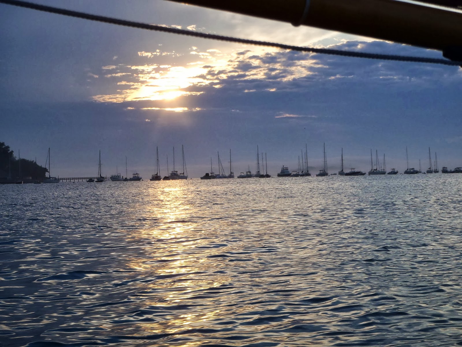
Sun lowering over Hingham Harbor.

What duck?

Bebe at anchor, Speedbump on beach.

Will tide go any lower?  Bebe's delicate bottom wants to know!

View from hilltop: Hingham Harbor in distance.

The east end of the island is covered with birds.  (I thought cormorants, but too stocky for that.)  Waves breaking on bar connecting island to nearby Spinnaker Island--a gated community.

Exploring the shoreline.

Birds scared off; Spinnaker Island's wall-to-wall condos.

In Hull, I admired Halcyon, which seemed ready to put to sea.

Fort Warren; old gun emplacements to left, newer watch tower at right.

Fort Warren is pretty big.

Our campsite.

On a dawn stroll, I scared up a flock of turkeys.  The young emerged one at a time from the marsh grass to join their impatient elders as I approached.

The whole gang finally gathered, the flock (upper center) begins to disappear into the bushes at my approach.

Philanthropist Albert Burrage built a children's hospital here about 1900, which was loaned to the military during WWI, and burned down in 1945.

Staghorn sumac, a small, fast-growing tree, dominates the island; I had never seen one this big.

A picnic table near the west end of the island gives this view of downtown Boston.

Among the many turkeys is on olster that is lame.

Slate and Grape Islands in the middle distance.  We have camped on Grape twice.

WWI mess hall reputedly could seat 1,800.

This house & stable dates from the early 19th century when the island was let to tenant farmers.
 

This beautiful lichen might be Xanthoria parietina.

Some trees were clearly planted, including many apple trees with good fruit, and this white birch (Betula papyrifera).


Our last lunch, and the view of downtown Boston from it.


Monday, September 10, 2012

Annual Camping Trip in Boston Harbor Islands


I was determined to get the boat upgrades done, and so worked on the wiring 'til the wee hours on Tuesday, spending some of the time scrunched in the cockpit installing wiring for the motor.  As a result, my left shoulder hurt and I got even less sleep than you'd expect, and I didn't begin packing the boat to go until the day of departure.  Every big trip I vow to be packed so as to leave early and well-rested, and every trip I do something like this.  And the lights don't even work!

Beatrice Ann, ready to launch.
We got off from Hingham in the middle of the afternoon, wove our way out the channel (because we could), and, with a fair but light wind, went ashore on Grape Island at 7:30pm.  (We'd have been ashore earlier, but I spent time reeling out anchor rode in an effort to get ashore dry-shod--a maneuver made more difficult with wind and current at an angle to each other.)  Leaving Stephen to keep the boat afloat on a falling tide, I went and found a ranger and got a cart to haul our gear.  At 7:45 I found Stephen with the boat hard aground.  To be fair, the bottom at that point was nearly level, so Stephen would have been hard-pressed to keep her afloat.  Stephen chose site 5--the same as two years ago--and we raced to get all the gear to camp and the tents pitched while we could still see.  We ate our soup in darkness and went to our separate tents for the evening.

Leaving Hingham Yacht Club astern.
We rose about 8am and breakfasted on oatmeal and croissants, coffee and juice.  A leisurely wander found  the boat still (or, rather, again) hard aground, so I relocated the anchor and shortened the rode before we set out by water taxi for Georges Island and its 19th century Fort Warren.

Water taxi leaving Grape.  Our boat is the speck grounded behind the bar in the center distance.
This time I remembered to bring headlamps so we could explore the fort's darker corners to our hearts' content.  Since this was our third year visiting as part of a Harbor Islands camping trip, we didn't feel compelled to see everything, but time in the visitor's center did  remind Stephen of the two Civil War bounty jumpers imprisoned and executed there--shot by a firing squad while standing beside their coffins--which sparked a conversation about capital punishment.  Stephen is generally against it, but had to admit that President Lincoln, also against it, needed to make an example of them.  Stephen is twelve, and feels these issues pretty deeply.

Lovells Island, seen from inside a watchtower in Fort Warren.
Finished with Georges after a modest lunch (that snack bar REALLY needs competition!--we decided to take a different water taxi to Lovells Island.  I was interested to see how its camp sites were arranged and how easy it would be to anchor safely in the event we decided to visit in the future.  This taxi dropped us there before 2pm, and we spent the next hour and a half circumnavigating the island.  We explored ruins and wondered about the tumble of granite blocks that lined the outer beach.  We also got ourselves in a bit of a fix trying to get around a cement foundation that had fallen from the bluff above to block our progress.  In making our way carefully around these enormous chucks of concrete, we found ourselves between tangles of reinforcing iron projecting from the concrete and deeper water than we felt comfortable wading.  Negotiating it without injury, we faced another obstacle: the next water taxi back to George would be too late to catch a ride on the original taxi back to Grape.  When I realized this in studying the schedule, a helpful ranger called the taxi company and got an agreement for the last taxi to drop us at Grape on the way back to their night-time dock in Hingham.  (On that final trip, we discovered we were not alone: three other couples came to Grape with us.)

Captain and crew of water taxi that graciously took us home.
Stephen likes to ride up front.
Back on Grape about 4pm, I was able to get out to the boat--now well afloat on high tide--and fire up the electric motor for a move to a nearer and more convenient anchorage.  Dropping the hook in about 8 feet of water, I calculated that the boat would still have a foot or two of water under her at low, but still be in reach of shore.

Low-grade slate that got my attention on Grape.  (I shouldn't have told Stephen to smile.)
I spent the late afternoon exploring the slaty rock that stands vertically on the western shore, and collect common periwinkle shells for future school use.  We ate a dinner of soup and bread while it was still daylight, then retreated into tents once fully dark.

Stephen loves to read in bed--same as at home.
Morning.  Breakfast is cooking.

Stephen slept late  waking to another leisurely breakfast.  We both explored a bit more, and then began breaking camp about 9:30am for 11am check-out.  The campsite was clean by shortly after 11, and the loading of the boat was fairly smooth owing to better organization than on earlier trips.

"Buzzing" the dock at Grape as we depart.

We had discussed possible activities for our last day, and decided to sail.  Stephen thought he might like to visit Nantasket Beach, while I wanted to sail into Boston proper.  We decided to try both, and set out for northward with a fair but light wind.  Stephen sailed us off the anchor, but was happy to return to his favorite spot on the foredeck once I was back in the cockpit.

Unexpected encounter with a (diesel) side-wheeler under Long Island Bridge.
We sailed gently under the Long Island bridge and into Dorchester Bay, then past Spectacle Island to starboard and seeing the beloved Corita gas tank far away to port.  Once past Spectacle, we were in Boston Harbor proper, sailing past the entrance to the inner harbor, flanked by Castle Island and Logan International Airport, among shipping great and small.  We had taken a long time to get this far; it was long after noon and a long sail home, and going into the inner harbor would have meant tacking out amid shipping large and small--clearly not an option.  So I decided to close the loop by going outside Long Island (President Roads), down the Nubble Channel, and back into Hingham Bay via Hull Gut.  It would give us more bang for the buck, and was only a little longer, I decided, than doubling back.

After a look and photos, we began working upwind in President Roads in light air, dodging first an incoming integrated tug-and-barge, then the general cargo vessel Arctic Blizzard, and later a cruise ship.  The Arctic Blizzard, lightly-loaded and showing much bottom paint and half her bow bulb, made her stately way past us.  Soon after, a smaller motor vessel with "PILOT" emblazoned on the side zoomed to her starboard side, looped around, and then came back.  I wondered whether she was picking up a pilot who had gotten the big ship out of the inner harbor, or was dropping off one who would get her out of Boston entirely.  The big ship remained stationary, and passing her we discovered she was riding from her starboard anchor.   A metal stair wend down her side about halfway to the water, and a rope ladder went the rest of the way: seeming to me a scary climb.  She remained in that position for as long as we could see her.

Fireboat.
Stephen and his sharp eyes spotted the fireboats first: looking like they were ready for a parade someone had forgotten to hold, they came out of the inner harbor with all water guns spraying.  A few minutes later they passed us--water thankfully turned off.  What could the fuss have been all about? 

Norwegian Dawn.
Later, as we approached the end of Deer Island and its spacy-looking sewage treatment plant, a police boat suddenly drew up and told us a cruise ship was coming and we should stay to the Deer Island side of the channel.  After my "ok" sign it jetted away to warn the next boater.  Meanwhile I turned to look.   It's hard to believe I could miss a big cruise ship speeding toward us, but so it was.  Only a few minutes later the Norwegian Dawn steamed past in a blaze of bright colors and incongruous artwork.  Perhaps the fireboats had been a send-off for her.

Passing Fort Warren.
After much light, fluky and sometimes non-existent wind and a foul current, we finally worked past Long Island as the wind shifted again and strengthened a bit.  From then on, my main worry was getting into Hingham before full dark, since the lights didn't work.  We sailed slowly south past Gallops Island and our old friend Georges, and approached Hull Gut just after 6pm.  Hull Gut has some of the strongest tidal current in the area, but I figured to beat the ebb since the moon was first quarter and high tide had only been an hour or so ago.  But entering the Gut I watched our speed drop from 3kt to 2 to 1.5 and finally to 1.2kt.   After a tense few minutes more it was clear we'd made it.

Now we had only to cross Hingham Bay to get to our ramp.  But as we approached the entrance to the harbor the sun set at last and the wind--now mostly foul--began to die away for good and all.   The tide was getting low enough for it to be risky to ignore the channel.  It was time to start the motor. 

We powered along cheerfully for awhile, sails still drawing most of the time, convincing me we were drawing little current.  We followed the coarse laid into the gps for an earlier trip when I thought we might come across Cape Cod Bay into Hingham late at night.  To my dismay, the battery began to give out, our speed dropping visibly until we made barely a knot.  i got out the paddle, but resisted the idea of switching to our other battery, which was under my bunk buried under a small mountain of camping gear.  My gps route wasn't entirely successful either, leading us aground once briefly, then taking us among moored sailboats some distance from the channel, but between gps and my floodlight, we found our way.  Finally, though, at 9:30 we touched the ramp, and the adventure was over.